Palisade Floaters Document Record Low Colorado River Flows
Paddlers in Palisade navigated ankle-deep water to document historic lows, revealing a 700 cubic feet per second gap threatening endangered fish in the critical 15-mile river reach.
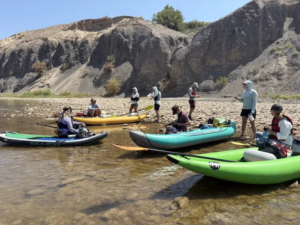
Aspen —The sun baked the rocks along the Palisade riverbank in mid-August. A bathtub ring marked where the water used to sit. Rusty farm equipment, long buried under sediment, now poked through the streambed like skeletal remains. Nine paddlers pushed their duckies and stand-up paddleboards into the shallows at Harky’s boat launch.
They were not there for leisure. They were documenting a crisis.
The Colorado River was hovering around 93 cubic feet per second (cfs). That is one of the lowest levels in recorded history for this stretch. The goal was to see how low it could go. The answer, visible in ankle-deep water and stuck hulls, was: very low.
Joel Sholtes organized the float. He is a water resources engineering instructor at Colorado Mesa University and coordinates the Grand Valley River Corridor Initiative. He knew the river was on "life support." He wanted to see it with his own eyes, and with those who manage its flow.
“It just felt important to be on it,” Sholtes said. “It just felt important to see it both from a habitat standpoint and from a user experience standpoint.”
The trip took four hours. Normally, the six-and-a-half-mile float from Palisade to Corn Lake takes two to three hours. Higher flows push you along. This year, the water barely pushed back. Paddlers got hung up on rocks. They dragged their craft through the mud and algae. Bright green algae grew between the stones. Herons and ospreys hunted in the exposed shallows.
This is the 15-mile reach. It runs from Palisade to the confluence with the Gunnison River. This stretch is chronically dry. It is also critical habitat for endangered fish. Water managers release water from upstream reservoirs each year to keep these populations alive. This year, the math is harder.
The winter snowpack was the lowest on record. Temperatures were exceptionally hot. Streamflows are dwindling. Farmers and ranchers have their irrigation water cut. Cities impose severe restrictions. The 15-mile reach is feeling the squeeze harder than most.
The recovery program holds pools of water in Lake Granby and Ruedi Reservoir. These are dedicated to boosting flows here. But the dry conditions mean less water is available to release. The numbers tell a stark story.
According to the Colorado Division of Water Resources, average August flows in this reach have been about 119 cfs this year. The target set by the Upper Colorado River Endangered Fish Recovery Program is 810 cfs.
That is a gap of nearly 700 cfs.
Make no mistake, this is not just a bad summer. This is a structural failure of the system’s buffer. The target exists for a reason. The fish need it. The current flow is less than half of what the plan calls for.
Sholtes noted that the river might even dry up in places. The float proved it. Boaters got stuck on rocks that are usually submerged. The riverbed, usually hidden, is now visible. It is a landscape of exposed history and present struggle.
The 15-mile reach is the bottleneck. It connects the agricultural diversions of Palisade to the Gunnison River. If this stretch fails, the ecosystem suffers. The water users suffer. The tourists who come to see the river find it diminished.
The float was a slow, deliberate test of that reality. It confirmed what the data suggests: the river is running on fumes. The snowpack is gone. The heat remains. The water managers are doing their best with what they have left.
It may not be enough.
Keep up with Aspen
The day's Western Slope news, one email each morning. Free.