Rock Climbing · Grand Junction, CO
Braveheart
Before you go
Live · nearest station Grand Junction, 1 miGood window today.
Mostly Cloudy
Feels like 62°
Storm chance
2% tonight
Wind
0 mph
Gunnison River near Grand Junction is running 1,170 cfs and falling, water 64°.
Distance
—
Elevation gain
3ft
High point
4,629ft
Season
Jan - Dec
About
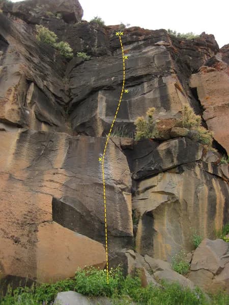
Braveheart is a two-pitch trad climbing route located in the Grand Junction area of Colorado's Western Slope, specifically within the Liberty Slab section of the Colorado National Monument. The route measures 340 feet (103 meters) and features a difficulty rating of 5.2 to 5.2R. It is situated left-center on a large, visible slab, accessible via the Corkscrew Trail area. The climb begins with a 5.2 pitch following the slab and crack system to an anchor point at a prominent tree. The second pitch, rated 5.2R, moves straight up toward the crack system where gear placement is the primary concern, trending slightly right before returning left to the high point. Climbers should carry BD #4 cams along with 0.75 and 3 sizes, plus long slings for anchoring to the tree or blocks on top. Descent involves walking left along an exposed ridge toward Otto pipes, scrambling down easy shelves for approximately 40 feet, and following a short trail to the Liberty Cap Trail. The walk back to the car takes about 15 minutes. Parking is available on site, and pets are permitted. The route is considered easy, making it suitable for beginners and those seeking a casual climb. It is accessible year-round.
Trail profile
Gain
3 ft
Avg grade
—
Steepest
—
High point
4,629 ft
Good to know
Parking at the trailhead
Dogs allowed on leash
Waypoints
Latest trail reportgood
Spring climbing conditions. Route may be wet after rainfall. Check weather forecast before climbing.
Reported Mar 3, 2025Verified
What people say
Reviews
No reviews yet
Been here? Help the next person out.
Within 30 miles