Rock Climbing · Silverton, CO
Cataract Gulch
Before you go
Live · nearest station Telluride, 8 miStorms are likely above treeline tonight. Start early and be off the ridge by midday.
Thunderstorms
Feels like 46°
Trailhead temp
38° est. at 11,605 ft
Storm chance
53% tonight
Wind
5 mph E
Distance
—
Elevation gain
3ft
High point
11,611ft
Season
Jan - Dec
About
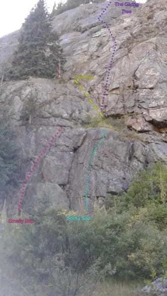
Cataract Gulch is a rock climbing destination near Silverton, Colorado, on the Western Slope. The site sits at an elevation of 11,605 feet and offers moderate difficulty routes. The primary feature is a 100-foot sheet of ice forming over a cliff at the bottom of the drainage, just above the river. This main ice section is approximately 100 meters long and yields to low-angle slab with trees along the left margin. The climb consists of 600 feet (182 meters) across two pitches. Climbers typically use one or two ropes and a standard ice rack. Parking is available off the pavement near the big curve south of town. The area is accessible year-round, though winter conditions require additional preparation and equipment. Localized avalanche hazard exists on the approach, which should be avoided on high-probability days. Pets are allowed at the site.
Trail profile
Gain
3 ft
Avg grade
—
Steepest
—
High point
11,611 ft
Good to know
Parking at the trailhead
Dogs allowed on leash
Waypoints
Latest trail reportgood
Spring climbing conditions. Route may be wet after rainfall. Check weather forecast before climbing.
Reported Mar 4, 2025Verified
What people say
Reviews
No reviews yet
Been here? Help the next person out.
Within 30 miles