Hiking · Durango, CO
Dutch Creek
Before you go
Live · nearest station Durango, 2 miGood window today.
Chance of Rain
Feels like 52°
Storm chance
30% overnight
Wind
0 mph
Animas River at Durango is running 782 cfs and rising, water 54°.
Distance
11.43mi round trip
Elevation gain
956ft
High point
7,518ft
Season
Jan - Dec
About
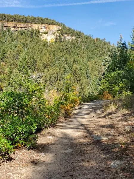
The Dutch Creek Trail in Durango, Colorado, is a multi-use route within the Hermosa Creek Special Management Area that connects with the Hermosa Creek Trail. The trail starts high on a ridgeline near 10,000 feet and descends to approximately 7,800 feet near its junction with the Hermosa Creek Trail. The first few miles follow the ridge, leading to open meadows that offer views of the La Plata Mountains to the west and the Needle Mountains to the east. The trail then drops into Stag Draw, passing grassy hillsides and open parks along Dutch Creek that serve as camping sites. The route includes numerous creek crossings, which can be significant in early summer. The final half mile features a climb before connecting to the Hermosa Creek Trail for a return or point-to-point option. The trail is open to hikers, bikers, and OHVs (50 inches or less) from May 1 to November 30. Year-round access is available for bikers. Parking is located on the north side of Hermosa Park Road, accessible via U.S. 550 and Elbert Creek Forest Road #581.
Trail profile
Gain
956 ft
Avg grade
2%
Steepest
3%
High point
7,518 ft
Good to know
Parking at the trailhead
Waypoints
Latest trail reportgood
Trail is in good condition. No significant obstacles or hazards reported.
Reported Mar 2, 2025Verified
What people say
Reviews
No reviews yet
Been here? Help the next person out.
Within 30 miles