Rock Climbing · Aspen, CO
Hero Loop
Before you go
Live · nearest station Aspen, 3 miGood window today.
Chance of Rain
Feels like 50°
Trailhead temp
47° est. at 8,698 ft
Storm chance
28% overnight
Wind
0 mph
Distance
—
Elevation gain
20ft
High point
8,724ft
Season
Jan - Dec
About
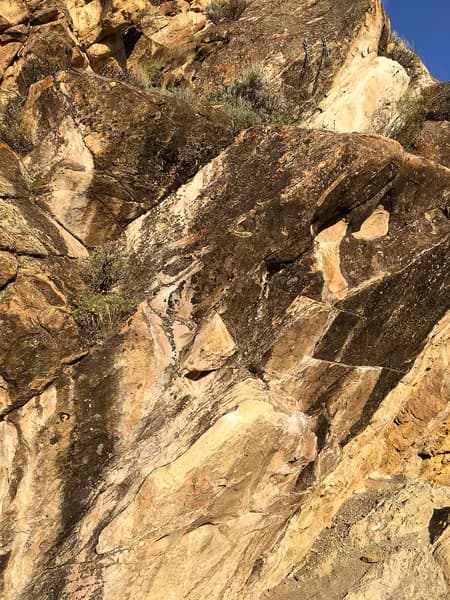
Hero Loop is a sport climbing route located on Gold Butte in Aspen, Colorado. The route is rated 5.9+ and spans approximately 50 feet. Climbers ascend through bulges using huecos, which are small hand and foot holds in the rock. The rock quality is described as soft but durable, making it suitable for repeated use. Protection consists of fixed bolts, allowing for sport climbing techniques without the need for placing gear. The route is situated in the middle of the wall, where huecos are clearly visible. Parking is available on-site, and pets are permitted. The elevation of the climbing area is listed as 8,698 feet in database records, though specific GPS coordinates place it near 39.2158 N, -106.84409 W. The area is accessible year-round, with climbing activity occurring from January to December. Guided services are available through Aspen Expeditions, offering short day trips of four hours and full-day options of six hours. These services include all necessary technical equipment such as ropes, helmets, harnesses, and shoes. Guides are AMGA certified and can accommodate climbers of all levels, from beginners to experts. The climbing venues are located within 15 to 30 minutes of downtown Aspen, providing views of the surrounding peaks and the Roaring Fork River. The route has a moderate difficulty level, challenging climbers without requiring highly technical moves. It is suitable for spending half a day on the rock.
Trail profile
Gain
20 ft
Avg grade
—
Steepest
—
High point
8,724 ft
Good to know
Parking at the trailhead
Dogs allowed on leash
Waypoints
Latest trail reportgood
Spring climbing conditions. Route may be wet after rainfall. Check weather forecast before climbing.
Reported Mar 3, 2025Verified
What people say
Reviews
No reviews yet
Been here? Help the next person out.
Within 30 miles