Rock Climbing · Montrose, CO
Ricky Baker
Before you go
Live · nearest station Montrose, 3 miGood window today.
Mostly Cloudy
Feels like 54°
Storm chance
12% overnight
Wind
0 mph
Distance
—
Elevation gain
—
High point
5,833ft
Season
Jan - Dec
About
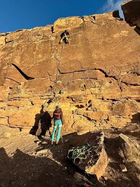
Ricky Baker is a sport climbing route located on the right side of Dry Creek Crag, approximately 15 miles west of Montrose, Colorado. The route is rated 5.10d in the Yosemite Decimal System and stands 40 feet (12 meters) tall. It was first ascended by Audrey Righter and is situated to the right of another route named The Gift. The climb begins with a straight ascent featuring minimal foot holds. Between bolts 2 and 3, climbers traverse right along a positive crimp rail. The route concludes with hard pull moves to the top. Although the face appears blank and intimidating, holds are present throughout. Access to Dry Creek Crag involves a 4WD road that is about one mile long, leading to the canyon rim. Drivers should go right at the first fork and left at the second to reach the climbing area. Parking is available near the site. The area is pet friendly. Dry Creek Crag is part of a larger local climbing zone on the Uncompahgre Plateau. The cliffs are composed of sandstone, ranging from 30 to 50 feet high, with many incut holds. The area contains over 30 mostly sport routes, typically featuring five to eight bolts per pitch along the highest half mile of sandstone on the east side of Dry Creek Canyon. While top anchors are rare due to soft caprock, they can be set on rock features or juniper trees. The climbing season is generally favorable in spring and fall, consistent with the broader Western Slope climate.
Trail profile
Gain
—
Avg grade
—
Steepest
—
High point
5,833 ft
Good to know
Parking at the trailhead
Dogs allowed on leash
Waypoints
Latest trail reportgood
Spring climbing conditions. Route may be wet after rainfall. Check weather forecast before climbing.
Reported Mar 3, 2025Verified
What people say
Reviews
No reviews yet
Been here? Help the next person out.
Within 30 miles