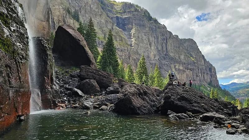
Rock Climbing · Telluride, CO
Sapphire Bullets of Pure Blue Ice
Before you go
Live · nearest station Telluride, 2 miStorms build later today. Plan an early finish.
Chance of Rain
Feels like 44°
Trailhead temp
42° est. at 9,915 ft
Storm chance
50% tonight
Wind
5 mph ESE
Distance
—
Elevation gain
145ft
High point
9,925ft
Season
Jan - Dec
About
Sapphire Bullets of Pure Blue Ice is a WI5-6 M5-6 ice and mixed climbing route located in the Bridalveil area of Telluride, Colorado. Situated approximately 400 feet to the right of Bridalveil Falls on the main headwall, this route is classified as moderate but demands technical precision. The climb consists of three pitches totaling roughly 400 feet, with parking available nearby and the route being pet friendly. Pitch one ascends a thin, vertical ice curtain on the right wall of a large corner. Climbers should expect to place knifeblades for protection and belay from a natural bench at the top. Pitch two continues up vertical ice that can be climbed as mixed terrain depending on conditions. This section is noted for being difficult to screw into, requiring careful gear placement. Pitch three involves climbing up a chimney to the summit, which offers mixed climbing options based on current weather conditions. The route can be rappelled for descent. While often compared to the nearby Ames Ice Hose, Sapphire Bullets is described as equally thin and steep but more demanding. It is considered a classic climb in the San Juan Mountains, with some climbers ranking it among their top five ice routes. Despite its quality, it is formed less frequently than Bridalveil Falls itself, making it a less crowded alternative. The climbing is engaging and excellent throughout all pitches without being desperate or overly difficult. Elevation for the area is 9,915 feet.
Trail profile
Gain
145 ft
Avg grade
—
Steepest
—
High point
9,925 ft
Good to know
Parking at the trailhead
Dogs allowed on leash
Waypoints
Latest trail reportgood
Spring climbing conditions. Route may be wet after rainfall. Check weather forecast before climbing.
Reported Mar 3, 2025Verified
What people say
Reviews
No reviews yet
Been here? Help the next person out.
Within 30 miles