Rock Climbing · Grand Junction, CO
Stonehenge
Before you go
Live · nearest station Grand Junction, 4 miGood window today.
Mostly Cloudy
Feels like 69°
Storm chance
5% tonight
Wind
5 mph SE
Distance
—
Elevation gain
143ft
High point
5,397ft
Season
Jan - Dec
About
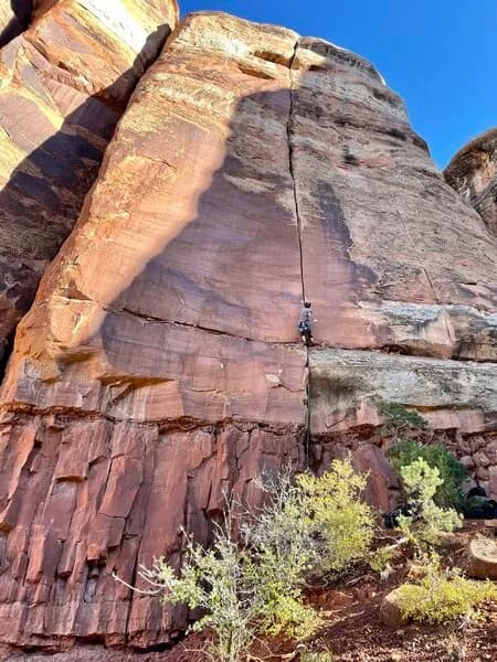
Stonehenge is a trad rock climbing route located near Grand Junction, Colorado, on the Western Slope. The specific route described is 65 feet tall and features a left-facing dihedral with loose fingers, followed by a pocketed finger crack with abundant features. Climbers finish with a reach or lunge to the top. The route was first ascended by KC Baum. Protection includes #0.75 Camalots, nuts, and gear for the top. The area offers parking and allows pets. Stonehenge sits at an elevation of 5,254 feet and is rated as difficult. While general climbing in the Grand Junction area spans from beginner to expert levels across sandstone and granite, this specific route targets experienced climbers. Access is available year-round.
Trail profile
Gain
143 ft
Avg grade
—
Steepest
—
High point
5,397 ft
Good to know
Parking at the trailhead
Dogs allowed on leash
Waypoints
Latest trail reportgood
Spring climbing conditions. Route may be wet after rainfall. Check weather forecast before climbing.
Reported Mar 3, 2025Verified
What people say
Reviews
No reviews yet
Been here? Help the next person out.
Within 30 miles
Nearby spots
Out of the Frying Pan Into the Fire
Serpents Trail