Rock Climbing · Grand Mesa, CO
The Jagged Edge
Before you go
Live · nearest station Delta County, 23 miGood window today.
Cloudy
Feels like 63°
Trailhead temp
44° est. at 10,217 ft
Storm chance
17% tonight
Wind
5 mph ESE
Distance
—
Elevation gain
13ft
High point
10,230ft
Season
Jan - Dec
About
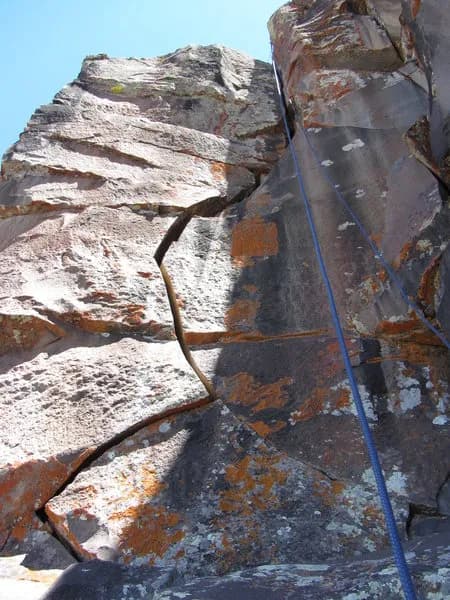
The Jagged Edge is a rock climbing destination on Grand Mesa, located in Western Colorado. The site sits at an elevation of 10,217 feet and offers difficult routes that require skill and physical endurance. Climbers typically spend about four hours on the outing. The area is accessible year-round, from January through December. Parking is available at the site, and pets are allowed on the trails. Access to Grand Mesa is primarily via Highway 65, known as the Grand Mesa Scenic Byway. This road connects to Interstate 70 in De Beque Canyon and leads eastward across the mesa. The geology of Grand Mesa consists of a basalt cap formed by lava flows approximately 10 million years ago. This hard volcanic rock protects the softer sedimentary layers beneath, creating a flat-topped landform with steep cliffs suitable for climbing. The specific route at The Jagged Edge climbs a wide, left-facing jagged flake. It is classified as a traditional climb with a length of 50 feet. The route features wide gear placements and includes a bolted anchor for protection. Recent records indicate the rock quality is good, though some sections may be fragile. The site is situated near the My Pet Goat area, requiring a short hike down from the main cliff face to reach. Climbers should prepare for variable terrain and potential snow or ice during winter months.
Trail profile
Gain
13 ft
Avg grade
—
Steepest
—
High point
10,230 ft
Good to know
Parking at the trailhead
Dogs allowed on leash
Waypoints
Latest trail reportgood
Spring climbing conditions. Route may be wet after rainfall. Check weather forecast before climbing.
Reported Mar 3, 2025Verified
What people say
Reviews
No reviews yet
Been here? Help the next person out.
Within 30 miles