Boulder Geologist Decodes 320 Million Years of Flatirons History
Hydrogeologist Bruce Manchon leads free tours of Chautauqua Park, explaining how tectonic uplift tilted 12,000 feet of sedimentary rock to create Boulder’s iconic red peaks.
Have you ever wondered what actually happens when a billion years of time get compressed into a single, jagged rock face?
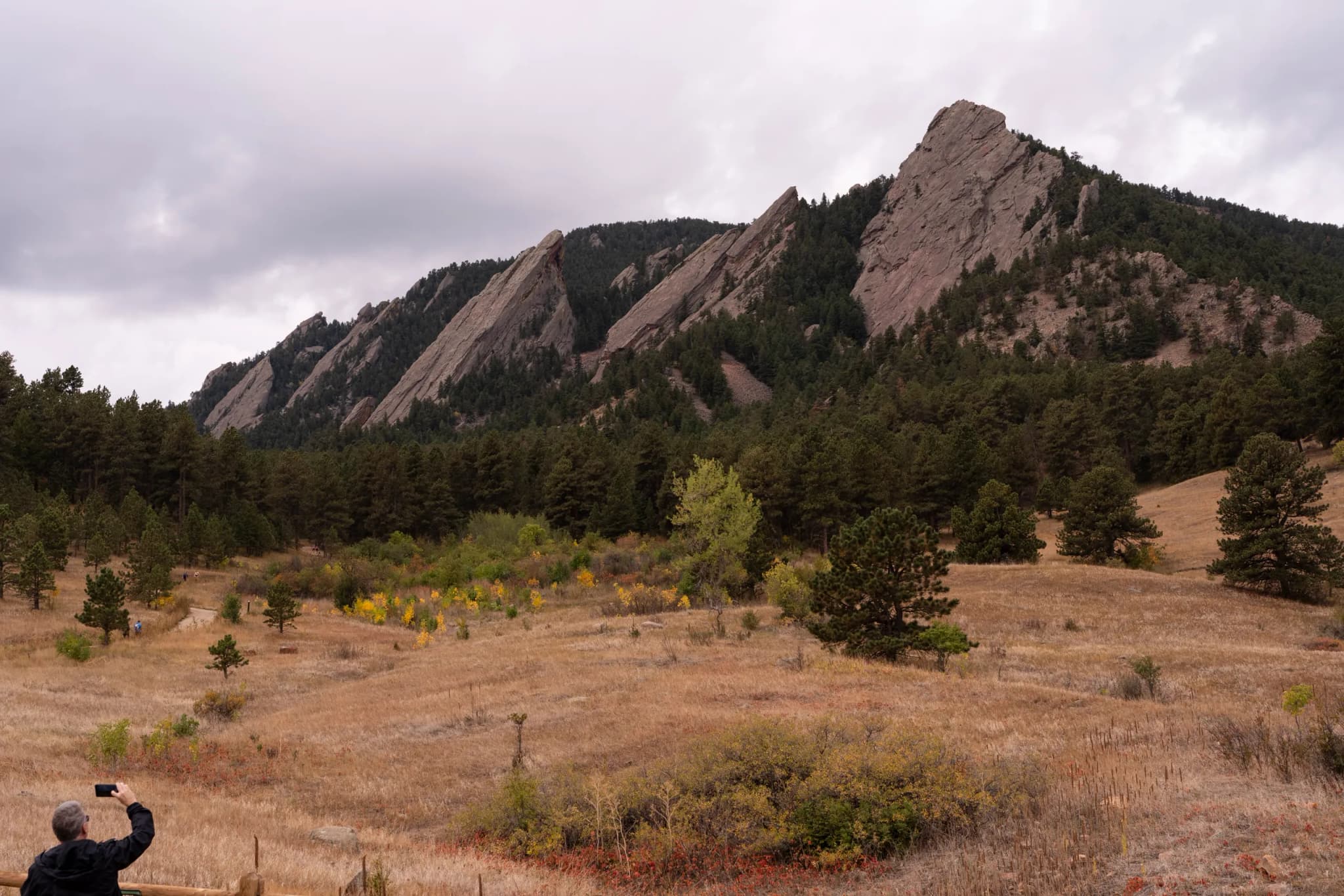
It’s the kind of question that lingers in your mind when you’re standing on a dirt path in Chautauqua Park, looking up at the five red peaks that define Boulder’s skyline. The sky was thick with dark-gray clouds on a recent Wednesday, the air heavy and cool, sprinkled with the first drops of yellow and orange leaves falling from the cottonwoods. A group of locals and tourists, bundled in just-in-case raincoats, walked the trail with a sense of quiet curiosity. They weren’t there for the view alone; they were there to understand how that view got here.
Bruce Manchon, a hydrogeologist and volunteer guide who studied geology at the University of Colorado in the 1970s, led them. He wears a tan hat that reads “Older than dirt” over his shock of white hair, and he doesn’t mince words about the deep time embedded in the landscape. “Rocks don’t tell lies,” he said, his voice steady against the wind. “They are telling a story.”
To understand that story, Manchon asks you to visualize the layers of an onion. Or a stack of pancakes. But now imagine that stack is rock, sediment, and fossils layered 12,000 feet deep over hundreds of millions of years. It’s a mental image that shifts your perspective on the ground beneath your feet. You’re not just standing in a park; you’re standing on top of a geological archive that includes fine grains of sand from when the landscape was dunes, layers of mudstone and lichen from low-water coastlines, shale from when Colorado was under a deep ocean, and sandstone from when beaches closed off the sea.
“Everything was layered, like we would a stack of pancakes,” Manchon explained to the group. “We had about 11 different layers stacked on top of where we are standing now.”
The transformation from a flat stack to the jagged spine you see today happened around 70 million years ago. As two of Earth’s tectonic plates pushed toward each other, one slid under the other, and the mountain range uplifted. Those ancient layers, once horizontal, were forced up almost vertically, tilting to 50 degrees. The pointy, red peaks began to rise, surfacing millions of years of sedimentary history in a single dramatic gesture.
The range is named after the heavy, flat-faced irons that pioneer women once heated up in the fire to press clothes, a domestic history layered over a geological one. But the story goes even deeper than the dinosaurs or the uplift. It begins 320 million years ago with the Ancestral Rocky Mountains, an ancient range whose erosion helped shape the basin where Boulder now sits.
Manchon’s tours are free and held every other week through November, a rare opportunity to walk the trail with an expert who can point out the specific textures and colors that mark these transitions. Runners, dog walkers, and a hiking group of new moms with babies strapped to their chests share the path with the tour group, creating a shared moment of pause in the middle of the valley’s daily rhythm.
As the tour winds up closer to the Flatirons, the scale of it all becomes undeniable. The red rock isn’t just a backdrop; it’s a record. It holds the weight of oceans that no longer exist and mountains that have already crumbled to dust, all preserved in the silence of the stone. You can feel it in the chill air, a reminder that the ground is never still, even when it looks like it’s just sitting there, waiting for you to look up.
Keep up with the Western Slope
The day's Western Slope news, one email each morning. Free.