South Fork Residents Face Months of Road Uncertainty After Floods
Record rainfall left South Fork's roads submerged, forcing officials to warn residents that safety assessments may delay access until spring while emergency crews are diverted to high-country rescues.
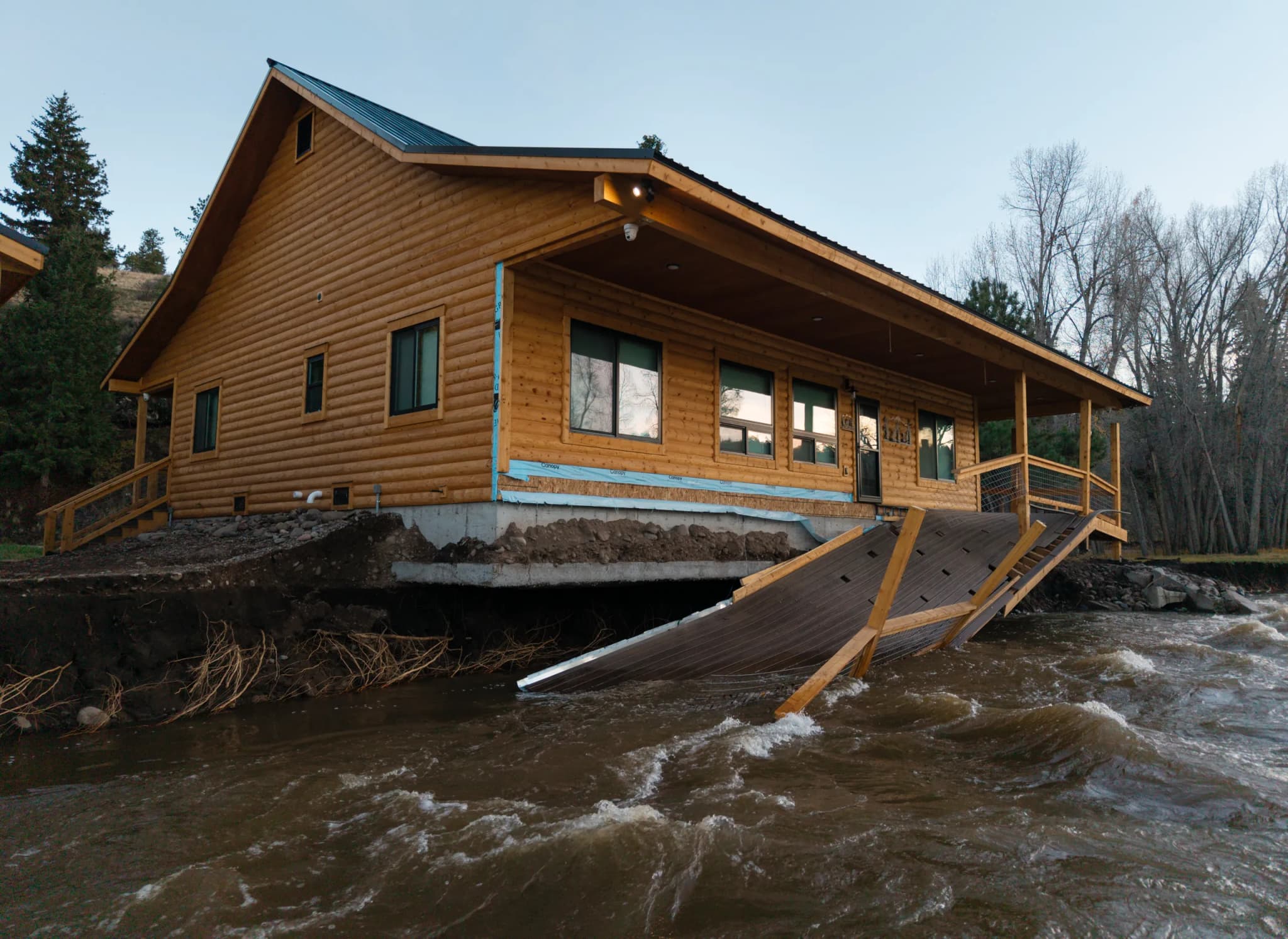
Durango —The rain stopped on Monday, leaving behind a silence that felt heavier than the storm itself. In the town of South Fork, the Rio Grande still churned with the memory of the deluge, a swollen artery of brown water that had swallowed bridges and threatened the foundations of homes. It was in the quiet, damp air of a local church hall that the true scope of the disaster began to unfold, not just as a weather event, but as a logistical crisis that stretched far beyond the immediate flood zone.
Patrick Moran, a district ranger with the Forest Service, stood before roughly 130 residents, his voice steady but carrying the weight of uncertainty. Another 200 people listened from their screens, their faces illuminated by the glow of laptops and phones. Moran didn’t mince words about the state of the infrastructure. “We don’t know the condition of all the roads. We have hundreds and hundreds of miles out there,” he told the crowd. The problem wasn’t just the water; it was the lack of knowledge about what lay beneath it.
The strain on local resources was becoming palpable. In Rio Grande County, one of at least a dozen counties battered by the flooding, sheriff’s deputies were being pulled away from helping flood victims to perform search and rescue operations in the high country. Hunters were stuck in the mud, and the sheriff’s team had to break off from their local duties to assist. “It is pulling resources out from the local effort here,” Moran noted, highlighting the competing demands on emergency personnel. He urged residents to stay put, warning that the assessment process for road safety could stretch into the spring. With snow already blanketing the higher elevations and more in the forecast, access to large chunks of the forest might not be possible until after the spring runoff.
The meteorological data underscores the severity of the event. Dennis Phillips, a NWS meteorologist in Grand Junction, stated that record precipitation had fallen in many areas of the Four Corners. The storm carried tropical moisture from the Pacific, dumping 2 to 5 inches of water on most of the San Juan Mountains, with some spots receiving over 6 inches. In Pagosa Springs, the San Juan River rose from about 5 feet to 15 feet in just two days — the second-highest crest since the record set in 1911. Gov. Jared Polis verbally declared a disaster emergency for 12 counties, acknowledging the widespread impact. In Rio Grande County alone, dozens of homes remained under evacuation orders as of Monday. The flooding washed away a bridge, shut down key roads, and even knocked radio stations off the air. A boil water advisory was issued after the sewage system became overwhelmed, adding a layer of public health concern to the physical destruction.
As the blue skies returned temporarily, the community faced the long work of recovery. The danger hadn’t washed away with the water; it had simply changed form. For now, the highest priority is staying put, waiting for the crews to clear the path, and trusting that the assessment, however slow, is necessary for safety. The next storm is expected to pass through the region starting Friday, a reminder that the sky above the valley is never truly calm.
Keep up with Durango
The day's Western Slope news, one email each morning. Free.




Cortez Upgrades Recycling Infrastructure With Producer Responsibility Fee Reimbursement

Durango Case Managers Win OpenAI Grant to Cut Paperwork