USGS and NASA remap Aspen’s Willoughby Basin with hyperspectral satellites
The USGS partners with NASA to survey Aspen’s Willoughby Basin using hyperspectral satellites, blending high-tech aerial scanning with historic prospecting methods to locate critical minerals.
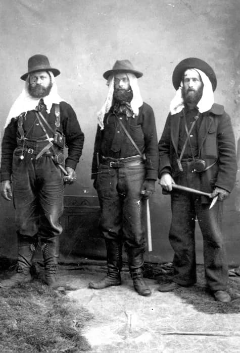
Aspen —The air up in the Willoughby Basin still holds the ghost of a pickaxe strike. It’s not just memory; it’s geology. For over a century, prospectors have walked these slopes, following hunches and rumors, searching for the veins of silver that built Aspen. Today, they are being joined by satellites.
This May, the United States Geological Survey announced a new program to remap roughly 400,000 square miles of the American West. The goal is simple: find minerals where they are. But the method has shifted from boots on the ground to birds in the sky. The USGS, based in Colorado Springs, has partnered with NASA to conduct a hyperspectral survey.
Planes fly 12 miles above the earth, scanning the land with instruments that differentiate tiny nuances in light wavelengths. These signals denote mineral-bearing rock. When a plane spots something interesting, people on the ground follow up with spectrometers to verify what’s below. The focus is sharp, particularly on legacy-mining sites like ours and potential sources for critical minerals such as copper and aluminum.
It’s a far cry from the 1879 origins of the USGS, which began with the simple task of inventorying America’s vast public lands. Back then, exploration was an act of wandering. Prospectors followed rumors or their own instincts, especially in the desert stretches of Nevada and California. Some were still doing it that way well into the 1960s.
Aspen’s early explorers took a more scientific route. Geologist Ferdinand Hayden was mapping Colorado when he reported that the geologic formations around Aspen mirrored those near Leadville. That work preceded the formal creation of the USGS, but it provided the data that justified its founding. Men like Jerome Powell compiled maps that already identified potential mineral sites, laying the groundwork for what would become a mining boom.
Today’s technology hasn’t replaced human judgment; it has augmented it. Gravimeters, electromagnetic instruments, and magnetometers are now standard tools alongside the older, trusted methods.
Yet, the core question remains unchanged: where do we find new deposits, and how much ore is left?
When the Aspen Times interviewed USGS geologist Josiah Edward Spurr in 1895, they pressed him on this exact issue. Spurr had examined Aspen without today’s high-tech instrumentation, but he possessed a unique advantage: he could see both the surface and the underground. His written analysis was thorough, supported by an atlas at a scale matching underground inspections, released in 1896 and still viewable at the Pitkin County Library.
Spurr’s answer to whether Aspen was running out of silver was confident, if perhaps slightly optimistic.
“District shows no sign of exhausting for many years to come,” Spurr said. “Not withstanding the fact that this camp is old and long-established, the character of the deposit is such that it will require many years to arrive at the roots, if indeed this is ever done.”
He was right. Even as mines like the Smuggler were only halfway through their prime, the geology held steady.
Stand there long enough and you can still see the old tunnels. Now, a plane flies overhead, mapping the same rock Spurr mapped with his eyes and notebooks. The tools have changed, but the silver is still there, waiting to be found.
Keep up with Aspen
The day's Western Slope news, one email each morning. Free.
Aspen's ACES Returns Annual Harvest Party to Rock Bottom Ranch
Glenwood Ghostwalk Brings Frontier History to Life in Linwood Cemetery