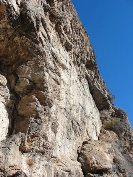
Rock Climbing · Glenwood Springs, CO
Bert
Before you go
Live · nearest station Glenwood Springs, 4 miGood window today.
Mostly Clear
Feels like 47°
Storm chance
2% overnight
Wind
5 mph SE
Roaring Fork at Glenwood Springs is running 454 cfs, water 55°.
Distance
—
Elevation gain
111ft
High point
8,843ft
Season
Jan - Dec
About
Bert is a 20-foot (6 m) rock climbing route located in the Puoux area of Glenwood Canyon, near Glenwood Springs, Colorado. The climb is rated 5.5 in the Yosemite Decimal System and offers both trad and sport options. It sits on the north face of a boulder named Bert, which is positioned centrally between two other large boulders. The route follows a right-trending flake feature and is considered suitable for beginners, though it includes one tricky high foot placement at the halfway point. Climbers can also stem out between the adjacent boulders for alternative moves. Access to Bert requires a waiver. The climbing area, known as Puoux (pronounced "pukes"), is located on the Defiance Cave Preserve, which is private property. Climbers must download, complete, and submit a climbing waiver to the property manager, Ken Headrick, via email. No specific day or time scheduling is required for submission. The area has maintained historical access to Interstate 70 and does not issue trespassing tickets for those who follow the waiver process. Parking is available at the site. The route was first ascended by Evan Winn in 2009. The Puoux area is one of the first sport climbing areas developed on Colorado's Western Slope, with development beginning in 1989. While much of Glenwood Canyon features loose rock, the limestone at Puoux provides stable climbing conditions year-round. The site is pet friendly and located at an elevation of 8,732 feet.
Trail profile
Gain
111 ft
Avg grade
—
Steepest
—
High point
8,843 ft
Good to know
Parking at the trailhead
Dogs allowed on leash
Waypoints
Latest trail reportgood
Spring climbing conditions. Route may be wet after rainfall. Check weather forecast before climbing.
Reported Mar 3, 2025Verified
What people say
Reviews
No reviews yet
Been here? Help the next person out.
Within 30 miles