Rock Climbing · Grand Junction, CO
Fast Draw
Before you go
Live · nearest station Grand Junction, 2 miGood window today.
Mostly Cloudy
Feels like 63°
Storm chance
2% tonight
Wind
0 mph
Gunnison River near Grand Junction is running 1,180 cfs, water 64°.
Distance
—
Elevation gain
672ft
High point
5,285ft
Season
Jan - Dec
About
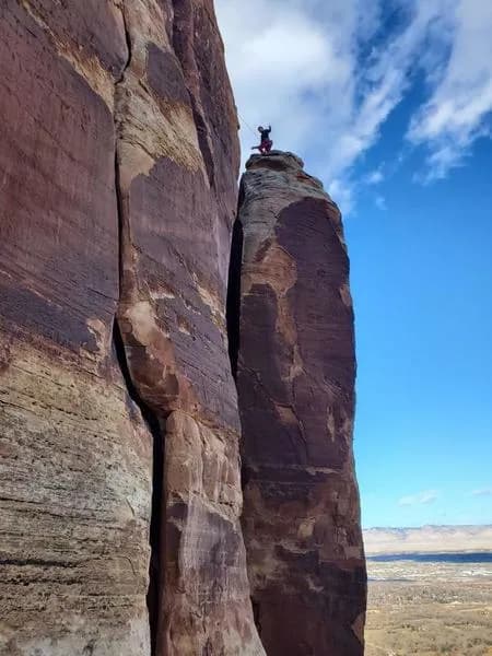
Fast Draw is a traditional rock climbing route located near Grand Junction, Colorado, at an elevation of 5,285 feet. The route consists of three pitches and is classified as Grade III with a difficult overall rating. It typically requires about six hours to complete, making it suitable for a full-day outing. The area offers on-site parking and allows pets. The climb begins with a technical start involving a finger-sized piece of protection on a lieback section, leading into a steep hand crack. Climbers traverse left to fixed pieces or continue up a less recommended grungy crack. The second pitch features sustained chimneying using big cams and old bolts, ending at a large ledge with a chain anchor. The third pitch continues the chimneying style with modern bolts and drilled angles to the summit. Protection relies heavily on hand-sized cams, though larger pieces (#4 and #5) are advisable for pitches two and three. The first ascent was recorded by Kor. Descent is accomplished via two rappels using a 60-meter rope. The first rappel goes to the top of the second pitch's chain anchor, and the second returns climbers to the ground. The route is accessible year-round. Nearby facilities include Grand Valley Climbing, a 12,000-square-foot indoor gym offering bouldering and lead climbing, and Grip Bouldering, which provides 24/7 access, youth programs, and adult clinics. These indoor options support local climbers with route setting and training equipment such as Kilter, Woods, and Moon Boards.
Trail profile
Gain
672 ft
Avg grade
—
Steepest
—
High point
5,285 ft
Good to know
Parking at the trailhead
Dogs allowed on leash
Waypoints
Latest trail reportgood
Spring climbing conditions. Route may be wet after rainfall. Check weather forecast before climbing.
Reported Mar 3, 2025Verified
What people say
Reviews
No reviews yet
Been here? Help the next person out.
Within 30 miles