Rock Climbing · Ouray, CO
Jay's Route
Before you go
Live · nearest station Telluride, 7 miStorms are likely above treeline tonight. Start early and be off the ridge by midday.
Chance of Rain
Feels like 45°
Trailhead temp
38° est. at 11,306 ft
Storm chance
58% tonight
Wind
5 mph ESE
Distance
—
Elevation gain
89ft
High point
11,306ft
Season
Jan - Dec
About
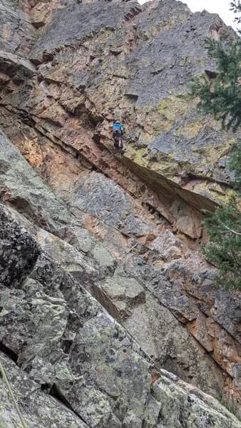
Jay's Route, also known as Deadpoint or No Parking, is a sport rock climbing route in Ouray, Colorado. Located at an elevation of 5786 feet, the climb is 45 feet high and rated difficult. The route features black bolts and follows a line left of a slight bulge near the climb 'Pleasing the Masses.' It sits in front of a large tree, just right of San Juan Snake. First ascended by Jay Smith in 2008, the spot offers parking nearby and allows pets. Climbers should consult Jason Nelson's guidebook 'Climbs of the Million Dollar Highway' for detailed information. The route is accessible year-round, though winter conditions may include snow and ice.
Trail profile
Gain
89 ft
Avg grade
—
Steepest
—
High point
11,306 ft
Good to know
Parking at the trailhead
Dogs allowed on leash
Waypoints
Latest trail reportgood
Spring climbing conditions. Route may be wet after rainfall. Check weather forecast before climbing.
Reported Mar 3, 2025Verified
What people say
Reviews
No reviews yet
Been here? Help the next person out.
Within 30 miles