Rock Climbing · Palisade, CO
Layleebock
Before you go
Live · nearest station Grand Junction, 13 miGood window today.
Mostly Cloudy
Feels like 65°
Storm chance
5% tonight
Wind
0 mph
Distance
—
Elevation gain
6ft
High point
4,744ft
Season
Jan - Dec
About
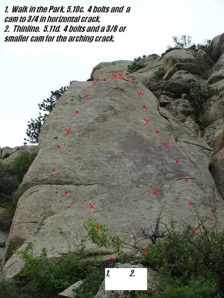
Layleebock is a 50-foot rock climbing route on Palisade Mountain, situated near the community of Palisade and Drake in Western Colorado. The route is rated 5.11a in the Yosemite Decimal System and holds a PG-13 grade for protection quality, offering both traditional and sport climbing options. The climb begins 12 feet to the right of a route named Can't or Won't. Climbers follow a shallow scoop and thin crack upward, laying gear to the left of the main crack line past two fixed bolts. A small nut fits below the first bolt, and jugs allow climbers to haul up while moving left around a flake. The top features a two-bolt anchor suitable for top-roping or leading. Protection requires gear up to 1 1/2 inches, with cams typically used for the flake section. The area is pet-friendly and offers parking. Palisade Mountain is located on the north side of Big Thompson Canyon along US Highway 34, between Loveland and Estes Park. The mountain rises over 2000 feet above Gateway and consists of granite rock. Most climbing areas on the mountain face south, allowing for year-round access with particular suitability in winter and early spring. The first ascent was made by Ned Sparks.
Trail profile
Gain
6 ft
Avg grade
—
Steepest
—
High point
4,744 ft
Good to know
Parking at the trailhead
Dogs allowed on leash
Waypoints
Latest trail reportgood
Spring climbing conditions. Route may be wet after rainfall. Check weather forecast before climbing.
Reported Mar 3, 2025Verified
What people say
Reviews
No reviews yet
Been here? Help the next person out.
Within 30 miles