Hiking · Fruita, CO
Rabbit Valley 4
Before you go
Live · nearest station Grand Junction, 12 miGood window today.
Sunny
Feels like 63°
Storm chance
6% afternoon
Wind
5 mph NW
Distance
3.3mi round trip
Elevation gain
384ft
High point
4,992ft
Season
Jan - Dec
About
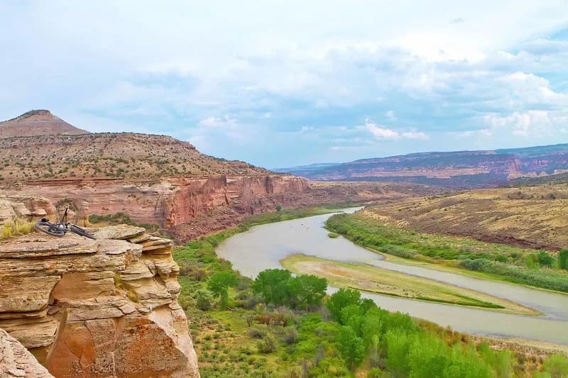
Rabbit Valley 4 is a 3.3-mile point-to-point hiking trail located near Fruita, Colorado, within the McInnis Canyons National Conservation Area. The trail is classified as difficult and typically takes about two hours to complete. Starting at an elevation of approximately 4,992 feet, hikers traverse a pinyon-juniper desert landscape characterized by sandstone formations and rimrock outcrops. The route crosses a broad valley with slight dips before ascending to the top of the rim via several short, steep climbs. These climbs are not technically difficult but require significant physical effort. The trail remains accessible year-round, from January through December, and parking is available at the trailhead. While the area is popular with motorcyclists, the trail surface shows minimal damage from their use. The route allows for hiking, biking, and dog walking, with dogs permitted off-leash. Hikers can follow signs along the rim past various optional turns. The trail is situated in a multi-use zone that straddles the Colorado-Utah border, offering views of red cliffs above the Colorado River.
Trail profile
Gain
384 ft
Avg grade
2%
Steepest
3%
High point
4,992 ft
Good to know
Parking at the trailhead
Waypoints
Latest trail reportgood
Trail is in good condition. No significant obstacles or hazards reported.
Reported Mar 2, 2025Verified
What people say
Reviews
No reviews yet
Been here? Help the next person out.
Within 30 miles