Hiking · Fruita, CO
Rabbit Valley 8
Before you go
Live · nearest station Grand Junction, 12 miGood window today.
Sunny
Feels like 63°
Storm chance
6% afternoon
Wind
5 mph NW
Distance
5.9mi round trip
Elevation gain
372ft
High point
4,942ft
Season
Jan - Dec
About
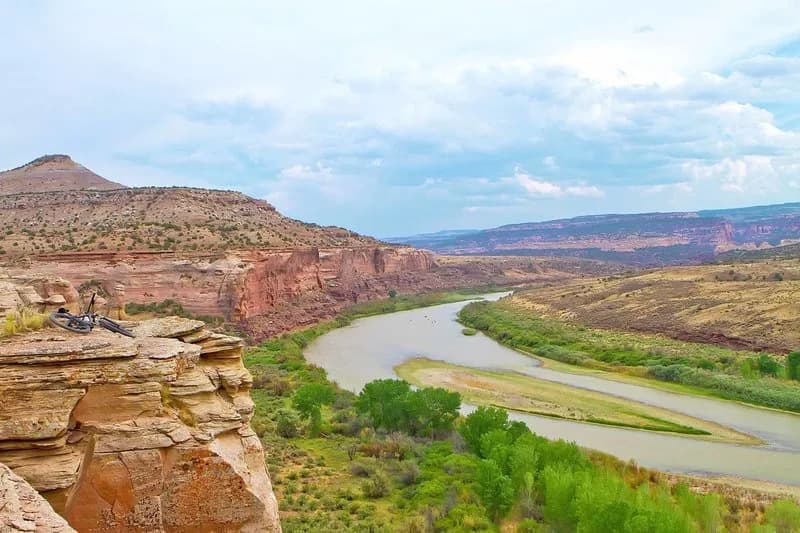
Rabbit Valley 8 is a 5.9-mile loop trail near Fruita, Colorado, classified as difficult with an elevation of 4,942 feet. The route typically takes about four hours to complete and features available parking at the trailhead. The trail is shared with mountain bikers, equestrians, and motorized vehicles. Access usually begins from Rabbit Valley 4 or 5, descending a rocky doubletrack south to the valley floor. The northern leg contours a cliff face with sandy terrain, leading to a turnaround point. From there, hikers descend east to an overlook of Mee Canyon along the Colorado River before returning via a rugged, rocky southern leg that maintains an easy gradient. The trail terminates back on the entry doubletrack. The surrounding area is pinyon-juniper desert with rimrock outcrops within the McInnis Canyons National Conservation Area.
Trail profile
Gain
372 ft
Avg grade
1%
Steepest
2%
High point
4,942 ft
Good to know
Parking at the trailhead
Waypoints
Latest trail reportgood
Trail is in good condition. No significant obstacles or hazards reported.
Reported Mar 2, 2025Verified
What people say
Reviews
No reviews yet
Been here? Help the next person out.
Within 30 miles