Hiking · Fruita, CO
Rabbit Valley Doubletrack
Before you go
Live · nearest station Grand Junction, 12 miGood window today.
Mostly Cloudy
Feels like 66°
Storm chance
8% afternoon
Wind
5 mph NW
Distance
1.2mi round trip
Elevation gain
227ft
High point
4,890ft
Season
Jan - Dec
About
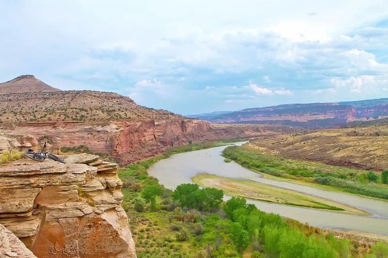
The Rabbit Valley Doubletrack is a 1.2-mile hiking trail near Fruita, Colorado, situated in the pinyon-juniper desert landscape of the Moore Canyon Area along the Colorado River. The route begins on the Kokopelli Trail and descends into the valley via a rugged doubletrack that serves as an access road for the Rabbit Valley 8 loop and the Rabbit Valley #4/8/3 Rim Loop. The trail is classified as difficult due to the rough terrain and elevation changes, requiring moderate to high physical fitness. The total elevation gain is listed at 4,890 feet, though specific elevation gain metrics vary by source. The trail is open year-round and typically takes about one hour to complete. A key feature is the viewpoint at the southern terminus, just south of the Rabbit Valley 8 intersection, which offers views of the Black Rocks. Parking is available at the trailhead. The trail is multi-use and can be hiked in either direction.
Trail profile
Gain
227 ft
Avg grade
4%
Steepest
4%
High point
4,890 ft
Good to know
Parking at the trailhead
Waypoints
Latest trail reportgood
Trail is in good condition. No significant obstacles or hazards reported.
Reported Mar 2, 2025Verified
What people say
Reviews
No reviews yet
Been here? Help the next person out.
Within 30 miles