Mountain Biking · Rifle, CO
Salty Rim
Before you go
Live · nearest station Glenwood Springs, 24 miGood window today. Daylight to 6:25 pm.
Thunderstorms
Feels like 60°
Storm chance
22% afternoon
Wind
5 mph W
Sun window
7:25 am to 6:25 pm
Distance
0.5mi round trip
Elevation gain
—
High point
5,754ft
Season
Apr - Octin season
About
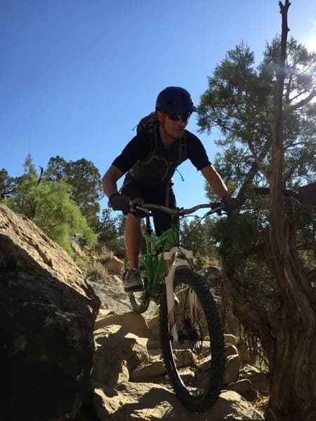
Salty Rim is a short, moderate singletrack mountain biking trail located near Rifle, Colorado, on the Western Slope. The route spans 0.5 miles with an elevation of 5,754 feet and typically takes between 3 to 7 minutes to complete. The trail is characterized by a fast, downhill descent along a steep embankment and a dry creekbed, featuring a distinct rim section that gives the trail its name. It is often used as a quick addition to the nearby Hot and Nasty trail, which serves as a common access point. Riders turn left onto the road where Hot and Nasty ends, pedal uphill briefly, and locate Salty Rim diving into the sagebrush on the left. The trail is accessible year-round from April through October, though conditions vary with weather. Parking is available at the nearby BLM parking lot, and the trail is pet friendly. The route is part of the Roan Cliff Chaos race format and is described as a fun, quick descent suitable for riders looking for a fast, technical feature rather than a long endurance ride.
Trail profile
Gain
—
Avg grade
—
Steepest
—
High point
5,754 ft
Good to know
Parking at the trailhead
Dogs allowed on leash
Waypoints
Latest trail reportgood
Trail is in good condition. Traction is good with minimal obstacles.
Reported Mar 2, 2025Verified
What people say
Reviews
No reviews yet
Been here? Help the next person out.
Within 30 miles