Rock Climbing · Glenwood Springs, CO
The Thread
Before you go
Live · nearest station Glenwood Springs, 1 miGood window today.
Mostly Cloudy
Feels like 58°
Storm chance
6% tonight
Wind
5 mph ENE
Roaring Fork at Glenwood Springs is running 434 cfs, water 58°.
Distance
—
Elevation gain
644ft
High point
7,334ft
Season
Jan - Dec
About
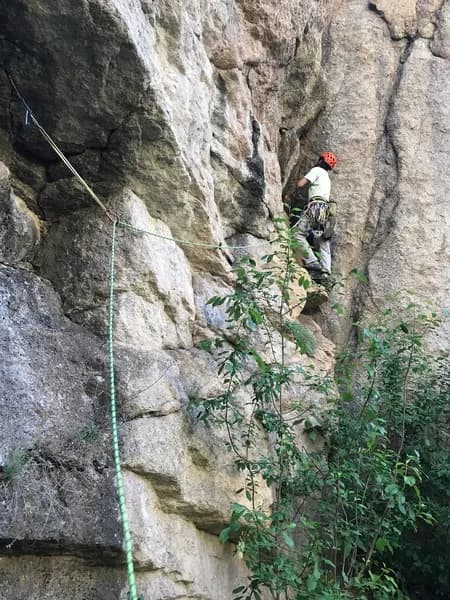
The Thread is a sport climbing route in Glenwood Springs, located on the Western Slope of Colorado. The crag sits at 7,334 feet elevation and features a single 90-foot (27-meter) route. Climbers approach the base via a trail, starting just left of where the path meets the rock face. A visible rope serves as an in-situ tie-off point near the start. The route consists of approximately eight bolts and one fixed pin, leading to a fixed anchor at the top. The climbing is rated moderate in difficulty. The terrain offers enjoyable but sometimes non-obvious holds, requiring attention to detail. A bulge near the middle of the route acts as the crux before climbers pull up to the anchor. Access is straightforward, with parking available for visitors. The site allows pets and is open year-round, from January through December. Seasonal conditions vary with elevation; winter months may bring snow and ice, while summer offers warmer temperatures. Spring and fall provide stable weather with crisp air. Climbers should bring proper shoes, hydration, and sun protection. The activity typically requires a half-day commitment, with an estimated duration of four hours including approach and descent. Guided options are available for those seeking instruction, though self-guided climbing is common.
Trail profile
Gain
644 ft
Avg grade
—
Steepest
—
High point
7,334 ft
Good to know
Parking at the trailhead
Dogs allowed on leash
Waypoints
Latest trail reportgood
Spring climbing conditions. Route may be wet after rainfall. Check weather forecast before climbing.
Reported Mar 3, 2025Verified
What people say
Reviews
No reviews yet
Been here? Help the next person out.
Within 30 miles
Nearby spots
Courage