Rock Climbing · Ouray, CO
Thong Wedgie
Before you go
Live · nearest station Telluride, 12 miStorms are likely above treeline tonight. Start early and be off the ridge by midday.
Chance of Rain
Feels like 45°
Trailhead temp
39° est. at 11,021 ft
Storm chance
58% tonight
Wind
5 mph ESE
Distance
—
Elevation gain
29ft
High point
11,033ft
Season
Jan - Dec
About
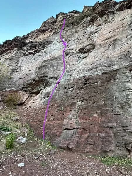
Thong Wedgie is a sport climbing route located in the Ouray vicinity on Colorado’s Western Slope. The primary route is classified as difficult, while an alternate finish, also known as Red Neck Wedgie, is rated 5.11a. The alternate finish is a 45-foot sport climb featuring five bolts leading to two top anchors. It is situated to the right of the Highway 550 Revisited route and includes a thin move at the top. The original Thong Wedgie route shares anchors with Highway 550 Revisited. Parking is available at the base, and the area is pet-friendly. While general sources suggest year-round accessibility, local conditions such as the CriticalGold Mountain Fire evacuation orders may impact access. Elevation data varies by source, citing 6,973 feet for the general destination and 11,021 feet in the database, though specific route elevations are not consistently defined.
Trail profile
Gain
29 ft
Avg grade
—
Steepest
—
High point
11,033 ft
Good to know
Parking at the trailhead
Dogs allowed on leash
Waypoints
Latest trail reportgood
Spring climbing conditions. Route may be wet after rainfall. Check weather forecast before climbing.
Reported Mar 3, 2025Verified
What people say
Reviews
No reviews yet
Been here? Help the next person out.
Within 30 miles