Mountain Biking · Aspen, CO
Upper & Lower Plunge trails (aka Sunnyside trail)
Before you go
Live · nearest station Aspen, 0 miGood window today.
Chance of Rain
Feels like 48°
Storm chance
28% overnight
Wind
0 mph
Distance
—
Elevation gain
—
High point
7,890ft
Season
Apr - Octpeak now
About
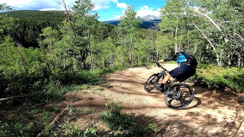
The Upper and Lower Plunge trails, collectively known as the Sunnyside trail in Aspen, Colorado, provide a difficult mountain biking experience at an elevation of 7,890 feet. The system consists of two steep sections connected by a short climb on Red Mountain Road. The Upper Plunge was rerouted in 2018 to feature grassy meadows within an aspen forest, rocky ledges, and fast turns. The lower alignment retains a rocky section that descends through dark timber forest. In 2021, the lowest portion of Lower Plunge was rerouted to avoid a rutted meadow, extending the path through aspen groves and rock gardens. The eastern bottom spur was also lengthened to connect directly to the uppermost bridge across Hunter Creek. Neither trail is recommended for uphill bike travel, making them primarily descent-focused routes. The trails are open from April through October and are dog friendly. Riders can access the Upper Plunge from 4 Corners Road or Red Mountain Road via Secret Trail. Lower Plunge is often ridden as a fast, rocky descent, frequently paired with a climb up the Hummingbird Trail to create a loop down to Hunter Valley North. The trail intersects with the Shadyside Trail and connects to the Rio Grande Trail near Roaring Fork River. Parking is available at the trailhead.
Trail profile
Gain
—
Avg grade
—
Steepest
—
High point
7,890 ft
Good to know
Parking at the trailhead
Dogs allowed on leash
Waypoints
Latest trail reportgood
Trail is in good condition. Traction is good with minimal obstacles.
Reported Mar 2, 2025Verified
What people say
Reviews
No reviews yet
Been here? Help the next person out.
Within 30 miles