Hiking · Fruita, CO
Zion Curtain Trail
Before you go
Live · nearest station Grand Junction, 12 miGood window today.
Mostly Cloudy
Feels like 66°
Storm chance
8% afternoon
Wind
5 mph NW
Distance
13.3mi round trip
Elevation gain
917ft
High point
5,415ft
Season
Jan - Dec
About
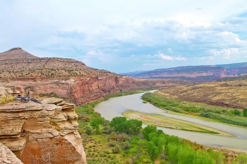
The Zion Curtain Trail is a 13.3-mile hiking route in Fruita, Colorado, situated in the Utah Rims Area near the state line. The trail forms a large loop around Bitter Creek, offering views of Castle Rocks and McDonald Creek Canyon. It begins under the I-70 overpass, where hikers follow a signed singletrack for approximately five miles through washes and technical hills to reach the rim. The remaining 5 to 7 miles traverse the rim before dropping into Rabbit Valley around mile eight or nine. At this junction, hikers intersect with the Kokopelli Trail and continue on an unmarked dirt road back toward the start. The route includes about 2,600 feet of total elevation gain and has an elevation of roughly 4,514 to 5,415 feet. The trail is classified as difficult and typically takes between eight hours and nine hours to complete. Parking is available at the trailhead, which remains accessible year-round.
Trail profile
Gain
917 ft
Avg grade
1%
Steepest
2%
High point
5,415 ft
Good to know
Parking at the trailhead
Waypoints
Latest trail reportgood
Trail is in good condition. No significant obstacles or hazards reported.
Reported Mar 2, 2025Verified
What people say
Reviews
No reviews yet
Been here? Help the next person out.
Within 30 miles