Gunnison River Dewatering Threatens Black Canyon Wilderness
Drought has reduced the lower Gunnison River to a trickle, threatening Black Canyon National Park and making the remote Gunnison Gorge inaccessible by October.
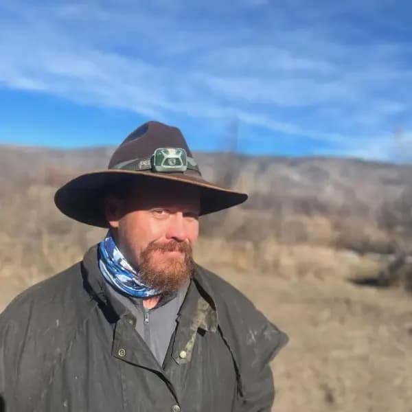
Gunnison —The wind off the Elk Mountains carries a dry, dusty scent that settles in your throat before you even reach the bluff. Below, at Pleasure Park, a weather-beaten outpost clinging to the edge of civilization, the North Fork of the Gunnison doesn’t crash or roar; it trickles. It unceremoniously slips into the mainstem, a thin ribbon of water that looks less like a river and more like a memory of one. In late August, clouds gathered in the distance with the promise of monsoon rain, wisps of moisture streaming out only to evaporate against the parched earth before they could touch the ground. It was a near-miss that felt personal, a failure of the sky to deliver what the land desperately needed.
Richard Richards wrote in the Vail Daily about this specific, aching view, noting that he drove to the bluff to process news that hasn’t yet been made official: by October, a significant portion of the lower Gunnison River in western Colorado will be fully dewatered. The term is clinical, bureaucratic even, but the reality on the ground is visceral. You can feel it in the silence where the current used to be, a hush that replaces the constant, low-frequency hum of moving water.
The Gunnison River begins high in the Elk Mountains and flows into Blue Mesa reservoir, Colorado’s largest body of water, though drought has currently demoted it to second place. From there, the river flows free through Black Canyon National Park, a gem that remains one of the least visited in the nation. But this freedom is conditional; most of its water gets diverted to irrigate farmland surrounding the towns of Delta and Montrose before it ever reaches the canyon. From above, the experience is limited to walking to outlooks and staring at sheer, colorful rock walls on the other side of a chasm that drops 2,000 feet.
Below Black Canyon lies the Gunnison Gorge Wilderness, a thin crack in the earth where Richards has spent the past 12 summers working as a wilderness fly-fishing river guide. Accessibility here is a relative term, defined by effort and endurance. To reach the water, you hike a rough 1.2-mile mule trail that drops steeply for almost 600 vertical feet. Getting to the trailhead takes an hour and a half from the nearest town, via a four-wheel-drive road that has served as the death knell for many low-clearance vehicles. It is rocky on a good day and often impassable when wet.
For those with the resources, mule packers can transport boats and gear; for those with youth and determination, backpacking is the only option. Even elite guests, including former presidents who book commercial trips, carry their personal gear down to the river. The reward is 14 miles of wilderness Gold Medal water, where the action peaks in June as large hungry trout key in on an epic salmon-fly hatch. But this stretch is not gentle. It features 18 named technical rapids, any of which can humble experienced river runners. Rapids called “Improvise,” “Boulder Garden,” and “Squeeze” feel more like rock than water, and almost every rapid has ruined a trip at some point. The river is littered with rocks that have strong personalities, earning names like “Queen of Hearts,” “The Table and Tombstone,” and “Dicky Do.” Some even carry the monikers of unlucky guides.
These barriers have kept crowds at bay, preserving a sense of remoteness that is increasingly fragile as the water level drops. The river’s character, defined by its technical difficulty and physical isolation, is now threatened not just by the terrain but by the absence of the water that makes it a river at all. As you stand on that bluff, watching the evaporating rain and the thin trickle below, the sadness isn’t just about a dry riverbed. It’s about the loss of a living system, one that has shaped the landscape and the lives of those who work within it for over a century. The wind picks up again, carrying that same dry dust, and the silence of the empty channel stretches out toward the horizon.
Keep up with Gunnison
The day's Western Slope news, one email each morning. Free.

ZGEO Pairs Geothermal Power With Housing And Industry In Montrose County
Hayden Council Votes to Classify Data Centers as Heavy Industry