Rock Climbing · Palisade, CO
Can't or Won't
Before you go
Live · nearest station Grand Junction, 13 miGood window today. Daylight to 5:06 pm.
Clear
Feels like 36°
Trailhead temp
37° est. at 5,440 ft
Wind
5 mph ESE
UV index
0 low
Sun window
6:47 am to 5:06 pm
Gunnison River near Grand Junction is running 1,690 cfs and falling, water 48°.
Distance
—
Elevation gain
3ft
High point
5,443ft
Season
Jan - Dec
About
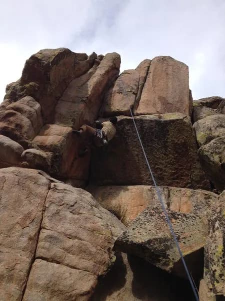
Can't or Won't is a rock climbing destination located in Palisade, Colorado, on the Western Slope. The site sits at an elevation of 5,440 feet and is characterized by difficult climbing routes. The area offers parking for visitors and allows pets on the premises. Climbers can access the site year-round, with conditions generally supporting activity from January to December. The estimated duration for a climb is approximately 4 hours, indicating a substantial commitment of time. While the specific rock type is not explicitly detailed in the provided sources, Palisade area climbing often features red rock formations. The difficulty level is classified as difficult, making it suitable for experienced climbers seeking a challenge rather than casual scrambles. The site is distinct from nearby Palisade Mountain, which contains various subcrags such as Horsehead Rock and Mikey's Island. Climbers should be aware that Colorado Parks and Wildlife notes potential hazards such as loose rock and unreliable fixed anchors in the region, though these are general conditions for the state rather than specific to this single spot. The location is accessible and functional for those planning a half-day climbing session in the Palisade community.
Trail profile
Gain
3 ft
Avg grade
—
Steepest
—
High point
5,443 ft
Good to know
Parking at the trailhead
Dogs allowed on leash
Waypoints
Latest trail reportgood
Spring climbing conditions. Route may be wet after rainfall. Check weather forecast before climbing.
Reported Mar 3, 2025Verified
What people say
Reviews
No reviews yet
Been here? Help the next person out.
Within 30 miles