Mountain Biking · Gunnison, CO
Dyke Trail Loop
Before you go
Live · nearest station Gunnison, 0 miStorms build later today. Plan an early finish.
Chance of Rain
Feels like 36°
Storm chance
67% overnight
Wind
10 mph SE
UV index
0 low
Sun window
7:33 am to 6:08 pm
Distance
—
Elevation gain
—
High point
7,705ft
Season
Apr - Octin season
About
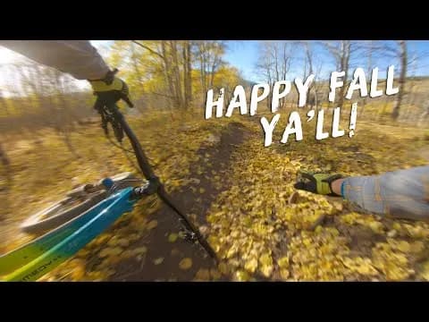
The Dyke Trail Loop is a difficult mountain biking route located in Gunnison National Forest near Crested Butte. The ride centers on the Dyke Trail, which descends from Lake Irwin to the Horse Ranch Park Trailhead. Riders typically access the trailhead by parking near the Irwin 'Y' junction on the way to Kebler Pass. The loop involves climbing up the Kepler and Irwin Roads before descending the trail, or taking a car shuttle to skip the initial climb. The trail is approximately 5 miles long and features smooth singletrack, loose technical descents, and several small creek crossings. The climb to the top of the Dyke is steep, followed by a downhill section through aspen groves with views of the Ruby and Anthracite mountains. The trail is accessible from April through October, though snow and mud may persist until mid-summer due to heavy winter snowfall in the Kebler Pass area. Parking is available at the trailhead, and pets are permitted.
Trail profile
Gain
—
Avg grade
—
Steepest
—
High point
7,705 ft
Good to know
Parking at the trailhead
Dogs allowed on leash
Waypoints
Latest trail reportgood
Trail is in good condition. Traction is good with minimal obstacles.
Reported Mar 2, 2025Verified
What people say
Reviews
No reviews yet
Been here? Help the next person out.
Within 30 miles