Grand County Firefighters Boost Manpower to Contain Fishhook Fire
Grand County incident commander Caleb Finch reports the Fishhook Fire covers 340 acres with 8% containment. Over 511 personnel are on site as crews secure lines against potential thunderstorm winds.
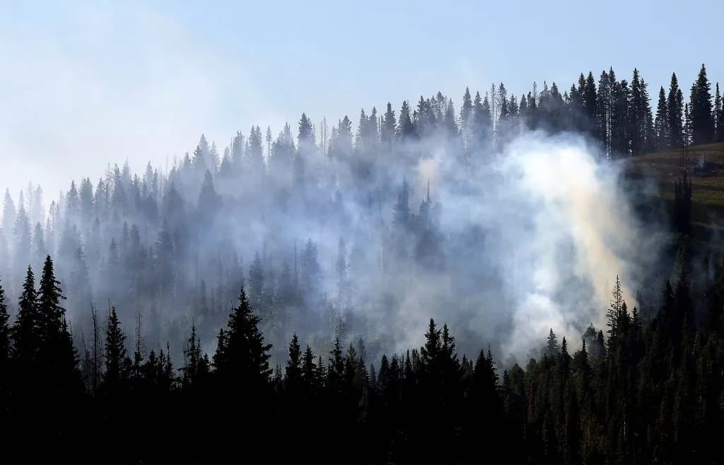
Steamboat Springs —The air above the Grand County high country still holds the dry, metallic scent of smoke. It’s a smell that sticks to your clothes and lingers in your lungs long after the flames are gone. On Monday morning, the Fishhook Fire settled into a deceptive calm. The flames weren’t roaring. They were smoldering. But the landscape remained tense, waiting for the next shift in wind or the next strike of lightning.
The official numbers tell a story of slight contraction, though not in the way locals might hope. The Fishhook Fire’s footprint has been adjusted to 340 acres. It is 8% contained. This update comes from the Southwest Area Management Team 1, which took over command early Friday. The size is down slightly from the 347 acres reported previously. But don’t mistake this for progress in the field. Incident Commander Caleb Finch clarified that the change is purely a result of more accurate mapping. The fire itself hasn’t shrunk. We’re just measuring it better.
The real story is the surge in manpower. As of Monday, 511 personnel are on the ground. That is well over double the 208 responders assigned just on Friday. The scale of the response is visible in the sky and on the roads. Nine crews are working the perimeter. Eighteen engines are staged. Seven helicopters are circling overhead, and two dozers are ready to cut lines.
Finch wrote that the fire’s continued low activity reflects the sustained work of air and ground resources. They are holding it in place. Favorable weather helped. But that weather is changing.
On Sunday, responders assessed property values at risk. Initial attack resources remained on standby. The priority was clear: if new fires started, they needed to be there. Finch noted that on the west side, firefighters increased containment by installing additional hose lay. They extinguished pockets of heat near the fire line. Along the northern edge, crews saw mostly interior burning. Helicopters supported the effort with bucket drops to cool heat near containment lines.
The eastern side saw crews building handlines. The south side saw further handlines and hose laying to combat heat along the edge. It’s a methodical grind. It’s not flashy. It’s just work.
Monday’s operations focus on securing what’s been gained. On the west side, firefighters are extending hose lay. They are conducting mop-up. They are securing containment lines. On the north side, responders will finish an incomplete section of containment lines. Then they will fly in additional resources to begin mop-up. The east side crews will continue identifying and extinguishing hot spots. They will begin “cold trailing” and mop-up. South side crews will continue mop-up and cold trailing to strengthen existing control lines.
The weather forecast offers a mix of relief and risk. Temperatures are expected to near 80 degrees at higher elevations. Humidity is decreasing. Winds are expected through mid-afternoon before a potential shift. Thunderstorms are anticipated to form later in the day. They could produce wind gusts of 20 to 25 mph. That creates locally unstable conditions in the fire’s area.
Finch wrote that fire behavior is expected to remain low to moderate. Primarily creeping and smoldering activity. But localized increases are possible. If warmer temperatures, lower humidity, and gusty thunderstorm winds align, the fire could wake up.
Initial attack resources will remain strategically staged. They are there to support the local unit. The threat is lightning from recent storms. If it strikes, new fire starts are a real possibility. The team is watching. The public needs to watch too. The fire isn’t going anywhere. It’s just waiting for the right conditions to expand.
Keep up with Steamboat Springs
The day's Western Slope news, one email each morning. Free.